Items where Author is "Lampeter., Peter Hopkins,Roderic Bowen Library and Archives, History, University of Wales"
 | Up a level |
Group by: Item Type | No Grouping
Jump to: Resource
Number of items: 1.
Resource
![[img]](http://www.humbox.ac.uk//656/1/PHI_00234-Kingdome_of_Ireland.jpg)
 Preview |
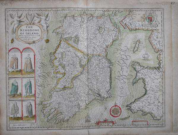
Early Maps: Kingdom of Ireland (1610)
Shared with the World by Dr Matt Phillpott
Map of the Kingdom of Ireland drawn by the English historian and cartographer John Speed in 1610. The map was used for description and travel. The original copy of this image can be found at the Roderic Bowen Library and Archives, University of Wales Lampeter.
Shared with the World by Dr Matt Phillpott


